### Quick Answer
> The GTA 6 map of Leonida is estimated to be 2.35 times larger than GTA 5’s San Andreas landmass, covering roughly 125 to 155 square kilometers of playable ground. It integrates dense urban architecture, extensive swamp ecosystems, dynamic open waterways, and over 70% enterable interiors.
| Feature / Metric | GTA 5 (San Andreas / Los Santos) | GTA 6 (Leonida / Vice City) |
| :--- | :--- | :--- |
| **Estimated Total Landmass** | ~48.7 km² (18.8 sq mi) | ~125 - 155 km² (48.2 - 59.8 sq mi) |
| **Total Bounding Box (Land + Water)** | ~75.8 km² (29.2 sq mi) | ~210 - 240 km² (81.0 - 92.6 sq mi) |
| **Primary Metropolitan Hub** | Los Santos (Single major city) | Vice City Metro (Multi-district sprawl) |
| **Secondary Settlement Density** | Sandy Shores, Paleto Bay (Sparse) | Port Vice, Hamlet, Ambrosia, Homestead (Dense) |
| **Enterable Interior Ratio** | ~5% to 8% of mapped structures | ~65% to 70% of urban & rural buildings |
| **Waterway & Wetland Playability** | Outer ocean ring, Alamo Sea | Grassrivers, Keys, Lake Leonida, Coastal networks |
| **Physics Engine Architecture** | RAGE 8 (Physics-driven vehicle mass) | RAGE 9 (Dynamic fluid, volumetric deformation) |
1. **Coordinate Telemetry Mapping**: Data extracted from leaked engine coordinates (X/Y/Z telemetry vectors) places key landmarks over 12,000 engine units apart, dwarfing Los Santos' maximum structural span.
2. **Biome Differentiation**: Leonida substitutes the uniform mountainous terrain of Mount Chiliad for intricate wetlands, shallow mangroves, barrier islands, and dense coastal urban centers.
3. **Vertical & Interior Volume**: City blocks in Vice City feature multi-tier structural interiors, subterranean transit networks, accessible roof access points, and operational elevators.
4. **Sub-Faction Regional Control**: Territory layout directly impacts localized ambient threats, shifting law enforcement response times, cartel ambushes, and local militia density based on county borders.

*The sprawling skyline of Vice City represents just one portion of the broader Leonida state landscape.*
---
## The Raw Mathematics: Square Kilometer Breakdown and Telemetry Analysis
Analyzing the physical footprint of Grand Theft Auto VI requires looking past simple trailer marketing cuts and inspecting raw engine telemetry data. When Grand Theft Auto V launched, its landmass spanned roughly 48.7 square kilometers (18.8 square miles). When including the surrounding oceanic border box, the total playable surface sat at approximately 75.8 square kilometers.
Rockstar Games designed San Andreas around a single massive central spine: Mount Chiliad, flanked by the Grand Senora Desert and capped at the southern tip by Los Santos. This geographic layout meant that over 40% of GTA 5's landmass comprised non-navigable mountainous inclines or sparse topography designed to limit sightlines and stretch the visual scope of the PlayStation 3 and Xbox 360 hardware.
Leonida operates on a vastly expanded physical grid. By utilizing leaked coordinate calculations from early engine debug builds—where absolute world units translate directly to real-world metric scales—the community-driven mapping projects have calculated the continuous landmass of Leonida between **125 and 155 square kilometers**. This figure excludes the vast marine territory of the Gator Keys and the outer shelf of the Atlantic Ocean equivalents.
```
GTA 5 Landmass [====================] ~48.7 km²
GTA 6 Landmass [==================================================] ~135 km² (Avg Est.)
```
The key spatial difference rests within usable floor space versus unnavigable geometry. In GTA 5, traveling from the South Los Santos Docks to the northern edge of Paleto Bay covers approximately 13 kilometers in a straight line. In Leonida, vector math calculated from the extreme southwestern tip of the Gator Keys to the northeastern perimeter of Kelly County indicates a linear traversal distance exceeding 29 kilometers.
This expanded spatial budget alters how speed, acceleration, and world streaming operate. Vehicle top speeds are recalibrated to fit this expanded scale. In GTA 5, high-end supercars were speed-capped around 120–125 mph to prevent outrunning asset streaming systems on 5400 RPM hard drives. With custom NVMe SSD architecture on modern hardware, RAGE 9 streams high-resolution PBR (Physically Based Rendering) assets at real-world highway speeds exceeding 180 mph without frame degradation.
---
## Regional Geography: Comparing Los Santos to the State of Leonida
GTA 5 presented a single major metropolitan hub (Los Santos) paired with small rural outposts (Sandy Shores and Paleto Bay). This left a massive rural void in the center of the map. Leonida completely overhauls regional distribution by spreading its mass across multiple distinct municipalities, industrial zones, and wild biomes.
```
┌────────────────────────────────────────────────────────────────────────┐
│ STATE OF LEONIDA MAP LAYOUT │
│ │
│ [ Kelly County / Industrial ] [ Ambrosia / Agricultural ] │
│ │ │ │
│ ▼ ▼ │
│ ┌────────────────────────┐ ┌──────────────────────┐ │
│ │ Lake Leonida Basin │─────────│ Port Vice Depots │ │
│ └────────────────────────┘ └──────────────────────┘ │
│ │ │ │
│ ▼ ▼ │
│ ┌────────────────────────┐ ┌──────────────────────┐ │
│ │ Grassrivers Swampland │ │ Vice City Metro Hub │ │
│ └────────────────────────┘ └──────────────────────┘ │
│ │ │ │
│ └────────────────┬───────────────┘ │
│ ▼ │
│ [ Gator Keys Archipelago ] │
└────────────────────────────────────────────────────────────────────────┘
```
### 1. Vice City Metropolitan Area
Vice City serves as the primary urban core, built on a dense grid that expands on real-world Miami, Miami Beach, and Broward County. Unlike the compact footprint of downtown Los Santos—which relies on steep hills to section off districts—Vice City spreads horizontally. High-rise corridors along Ocean Drive, Starfish Island equivalents, and Downtown Vice City feature wide multilane boulevards, public rail systems, coastal boardwalks, and active commercial complexes.
### 2. Port Vice and Industrial Corridors
Located southeast of the urban core, Port Vice functions as a heavy industrial shipping hub. It dwarfs the Port of Los Santos from GTA 5, incorporating automated container yards, freight rail connections, security checkpoints, and deep-water docks capable of housing large commercial cargo vessels. This region hosts the San Chianis Cartel and localized smuggling rings, creating hostile ambient zones where high-tier vehicle transport heists occur.
### 3. Kelly County and Lake Leonida
Replacing the arid dirt tracks of the Grand Senora Desert, Kelly County is defined by pine barrens, red-dirt racing circuits, dirt-track trailer parks, and industrial refineries. At its center lies Lake Leonida—an expansive inland body of water modeled after Lake Okeechobee. This lake acts as a central liquid junction connecting northern riverways directly to the southern marshlands, offering uninterrupted watercraft transit across the state.
### 4. The Grassrivers (Everglades Ecosystem)
The Grassrivers represent a massive structural departure from GTA 5. Where San Andreas used vertical cliffs to wall off areas, Leonida uses dense, treacherous waterlogged wetlands. The Grassrivers feature mudbanks, dynamic tidal channels, tall sawgrass fields, and hidden moonshine/smuggling cabins. Navigating this biome requires airboats, mud-spec off-road trucks, or specialized light aircraft.

*The Grassrivers biome introduces shallow-water physics and dynamic wildlife behavior missing from previous titles.*
### 5. The Gator Keys Archipelago
Extending off the southern mainland coast, the Gator Keys form a long chain of low-lying coral limestone islands linked by low-clearance bridges and causeways. This string of islands covers a massive oceanic boundary box, creating dedicated space for open-sea navigation, illegal drug-running runs via speedboats, deep-sea diving spots, and remote airfield drops.
---
## Structural Density and Interior Accessibility
Square footage alone does not convey a map's true size. A key weakness of GTA 5’s world design was its static, hollow urban geometry. Outside of dedicated mission instances, safehouses, and a small hand-pick of clothing shops or Ammu-Nation stores, over 92% of structures in San Andreas were sealed prop boxes.
Leonida changes this framework through volumetric interior integration. As detailed in our breakdown of
every confirmed and rumored enterable building in Leonida, Rockstar has drastically increased the ratio of accessible interior space.
```
GTA 5 Interior Ratio: [== ] ~8% Accessible
GTA 6 Interior Ratio: [=================== ] ~65% Accessible
```
### Commercial and Residential Depth
* **Pawn Shops and Convenience Outlets**: Store interiors feature fully modeled point-of-sale systems, rear storage rooms, security offices, and breakable glass cases.
* **High-Rise Hotels and Motels**: Properties along Vice Beach and inner-city corridors house functional lobbies, elevator systems, service hallways, and access to individual guest rooms. Players can execute vertical escape routes during high-level law enforcement chases.
* **Nightclubs and Entertainment Venues**: Clubs feature multi-floor layouts, VIP lounges, basement storage, back-alley unloading docks, and dynamic crowds containing hundreds of individual NPCs using procedural animation systems.
* **Warehouses and Distribution Logistics**: Port Vice structures feature clear interior routes, allowing players to drive trucks, forklifts, and getaway vehicles directly into buildings to escape police helicopter searchlights.
```
[ STREET LEVEL ENTRY ]
│
├──► [ Public Lobby & Elevators ] ────► [ Rooftop Helipad Access ]
│
├──► [ Rear Service Corridors ] ────► [ Underground Parking Garage ]
│
└──► [ Vault / Storage Basements ] ──► [ Municipal Sewer Network ]
```
This structural depth transforms how tactical gameplay unfolds. In GTA 5, a 5-star wanted level usually meant finding a straight highway to outrun police cruisers or driving up a mountain path. In Leonida, players can slip into a multi-tier shopping center, break into maintenance crawlspaces, change clothes in a utility room, and exit onto a adjacent side street while law enforcement clears the primary perimeter.
---
## Technical Comparison: RAGE 8 vs. RAGE 9 Map Rendering Architecture
The expansion from San Andreas to Leonida is made possible by generational upgrades in engine architecture. GTA 5 was built on early iterations of the Rockstar Advanced Game Engine (RAGE 8), designed to fit within the 512MB unified memory limit of seventh-generation consoles. Leonida leverages the upgraded RAGE 9 engine, built from the ground up to utilize modern PC hardware and ninth-generation consoles.
For detailed hardware breakdowns regarding how modern systems handle these massive asset loads, consult our comprehensive breakdown on
GTA 6 frame rate caps and console performance limits.
```
┌───────────────────────────────┬───────────────────────────────────┬───────────────────────────────────┐
│ ENGINE FEATURE │ RAGE 8 (GTA 5 Architecture) │ RAGE 9 (GTA 6 Architecture) │
├───────────────────────────────┼───────────────────────────────────┼───────────────────────────────────┤
│ Spatial Partitioning │ Flat 2D Cell Grid │ Octree Volumetric 3D Grid │
│ Water Physics Engine │ Surface Mesh Displacement │ Real-time Navier-Stokes Fluid │
│ Atmospheric Fog / Lighting │ Height-based Static Fog │ Heterogeneous Volumetric Media │
│ Vegetation Density │ Billboard Sprites at Distance │ Full PBR Foliage Instancing │
│ Vehicle Deformations │ Fixed Node Mesh Deformation │ Real-time Physics-based Crushing │
│ Max Traversal Velocity │ Hard capped at ~120-125 MPH │ Dynamic streaming > 180+ MPH │
└───────────────────────────────┴───────────────────────────────────┴───────────────────────────────────┘
```
>
[PRO-GAMER TACTICAL HACK]: When traversing the deep Grassrivers region with high-tier contraband, avoid using deep-draft speedboats. The dynamic mud and water-depth physics in RAGE 9 will drag your hull down in low-tide zones, causing low-RPM turbo lag and stranding you in open alligator habitats. Always secure a wide-skid flat-bottom airboat or a lifted off-road vehicle with a snorkel intake before entering open marsh territory.
---
## Environmental Physics, Micro-Factions, and Regional Mechanics
The increased scale of Leonida directly feeds into local faction dynamics and dynamic weather systems. San Andreas maintained a relatively uniform weather state across its entire map. In contrast, Leonida uses regional micro-climates managed by procedural weather simulation.
```
[ DOWNTOWN VICE CITY ] [ THE GRASSRIVERS ] [ THE GATOR KEYS ]
Heavy Tropical Rain ───► Dense Ground Fog ───► High Velocity Winds
Low Visibility Mud Path Formation Turbulent Swell Waves
Tire Aquaplaning Traction Loss (-40%) Vessel Capsizing Hazard
```
### Localized Faction Control and Law Enforcement Responses
The map is partitioned into localized jurisdictions. Unlike GTA 5—where the Los Santos Police Department (LSPD) handled urban calls and the Los Santos County Sheriff's Department covered rural areas with identical AI pursuit logic—Leonida introduces distinct faction behaviors and law enforcement tactics across county lines.
```
┌─────────────────────────────────────────────────────────────────────────┐
│ LEONIDA COUNTY JURISDICTIONS │
├───────────────────────┬─────────────────────────┬───────────────────────┤
│ COUNTY DISTRICT │ LOCALIZED FACTION / LAW │ AI TACTICAL BEHAVIOR │
├───────────────────────┼─────────────────────────┼───────────────────────┤
│ Vice City Metro │ Vice City Police (VCPD) │ Pit maneuvers, spikes, │
│ │ & Tactical SWAT │ chopper spotters │
├───────────────────────┼─────────────────────────┼───────────────────────┤
│ Kelly County │ County Sheriffs & │ Heavy RAM trucks, │
│ │ Local Vigilante Guilds │ off-road blockades │
├───────────────────────┼─────────────────────────┼───────────────────────┤
│ Grassrivers Swamps │ State Wildlife Officers │ Swamp airboats, thermal│
│ │ & Thrillbilly Mud Club │ tracking, ambushes │
├───────────────────────┼─────────────────────────┼───────────────────────┤
│ Port Vice / Docks │ Port Authority & San │ Lethal automatic fire,│
│ │ Chianis Cartel Heavy │ heavy vehicle armor │
└───────────────────────┴─────────────────────────┴───────────────────────┘
```
When operating inside Vice City Metro, the VCPD deploys high-speed interceptors, sets up road spikes, and uses police choppers with high-intensity spotlights. If you cross into Kelly County, local sheriffs employ aggressive rammed blockades using heavy-duty pickup trucks.
Pushing further into the Grassrivers puts you up against localized paramilitary outfits and swamp-native vigilantes who utilize the environment against you. They will shoot out your tires in shallow water traps and flush your position out into open alligator nests.

*Faction-controlled territory dictates the heavily armored gear and weaponry required to survive outside city limits.*
---
## Dynamic Waterways and Aquatic Traversal
Water coverage in GTA 5 served mostly as a map boundary. Aside from basic jet-ski rides, scuba diving collectible hunts, and minor smuggler runs, the ocean surrounding San Andreas was vast, empty space.
Leonida elevates water from an outer barrier to a central gameplay space. Based on the geographic template of South Florida, water channels run through the heart of the playable terrain.
```
┌────────────────────────────────────────────────────────────────────────┐
│ LEONIDA WATERWAY NETWORK │
│ │
│ Ocean Shelf ──► Outer Barrier Islands ──► Ocean Drive Inlets │
│ │ │
│ ▼ │
│ Coastal Canal Grid ◄───────────────────── Inner City Lagoons │
│ │ │
│ ▼ │
│ Lake Leonida Basin ──► Marsh Drainage Rivers ──► Deep Swamp Channels │
└────────────────────────────────────────────────────────────────────────┘
```
1. **Hydrological Physics**: Water flow is calculated using dynamic buoyancy, surface tension, and depth-based drag vectors. Deep-draft yachts behave sluggishly in shallow canals, while light jet skis flip if driven perpendicularly across heavy ocean swells.
2. **Naval Smuggling Routes**: Offshore waters feature hidden drop points outside federal patrol zones. Players can transport high-value cargo from deep ocean barges into city canals via silent watercraft.
3. **Underwater Ecosystems**: Coral reefs, sunken shipwrecks, and submerged cargo containers span the coastal waters around the Gator Keys, requiring dedicated diving equipment and underwater prop-locomotion vehicles to explore fully.
>
[ROOKIE MISTAKE TO AVOID]: Do not attempt to cross Lake Leonida or open Grassrivers channels using stolen high-performance supercars via low-clearance bridges during tropical storm events. Dynamic water swells splash over barrier causeways, drowning low-slung engine intakes instantly. Lock up your vehicle, hydroplane across open water, and get stranded without cover in hostile alligator territory. Always keep a high-clearance 4x4 or an amphibious vehicle staged near coastal access points.
---
## Real-World Scale and Traversal Time Comparisons
To put Leonida's physical footprint into perspective, we must look at traversal telemetry. Traversal time measures how long it takes a player to cross the map using various transit methods. Below is a detailed breakdown comparing standard transit benchmarks across GTA 5 and GTA 6.
```
TRANSIT BENCHMARK TIMES (APPROXIMATE)
GTA 5: Grapeseed to LSIA Highway Run (Supercar @ ~110 MPH)
[======] 4 Minutes, 15 Seconds
GTA 6: North Kelly County to Gator Keys South (Supercar @ ~140 MPH)
[===============================] 11 Minutes, 45 Seconds
GTA 5: Coast-to-Coast Helicopter Transit (Frogger @ Max Velocity)
[=====] 3 Minutes, 40 Seconds
GTA 6: Coast-to-Coast Helicopter Transit (Maverick @ Max Velocity)
[==========================] 9 Minutes, 20 Seconds
```
### What Scale Means for Gameplay Infrastructure
* **Gas Station Economy & Vehicle Upkeep**: Because traversal spans such long distances, vehicle fuel limits, tire wear mechanics, and engine overheating under continuous high-RPM load become actual gameplay factors during extended multi-county pursuits.
* **Flight Navigation**: Aircraft serve a operational purpose rather than acting as mere novelties. Flying high-speed jets or cargo planes requires paying attention to local radar grids, military air defense zones over federal naval bases, and dynamic weather patterns like localized lightning strikes.
* **Property Investment Strategy**: Real estate strategy shifts dramatically based on map position. Owning safehouses and staging warehouses across multiple distant counties allows players to drop off contraband, switch getaway vehicles, and reset regional search levels without undertaking lengthy cross-state drives under high police heat.
For a deeper look into how Rockstar's massive world design budget compares to other media projects, check out our analysis on
GTA 6 production budget and scope analysis.
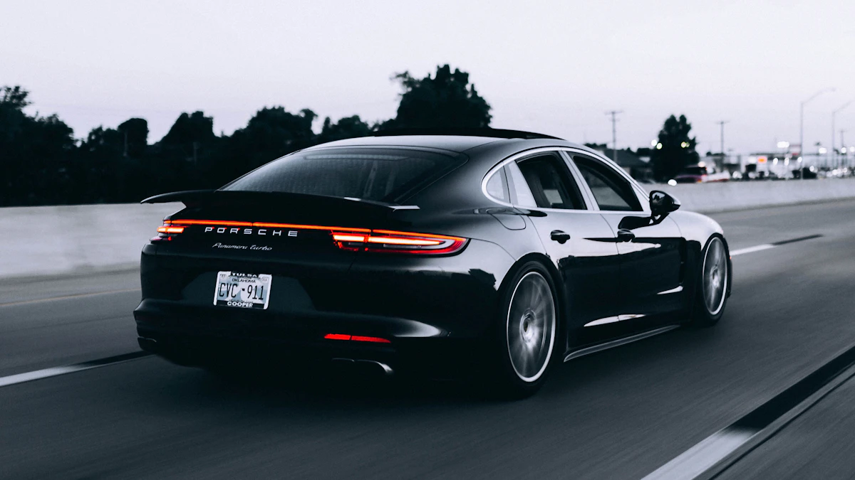
*Long-distance highway travel across Leonida requires proper vehicle tuning and heat management.*
---
## Regional Financial Real Estate Ecosystem: US/UK Market Breakdown
The sheer size of Leonida directly shapes its in-game real estate economy. In GTA 5, property acquisitions were fairly basic—you bought a single garage or one of a few designated safehouses. In Leonida, the multi-county layout underpins a complex real estate market.
Properties range from low-end run-down motels in Kelly County to multi-million-dollar oceanfront penthouses along Vice Beach. This system ties directly into how players manage money, store vehicles, and set up safehouses near key heist targets.
```
┌──────────────────────────────────────────────────────────────────────────┐
│ LEONIDA REAL ESTATE VALUE GRID │
├─────────────────────┬──────────────────────┬─────────────────────────────┤
│ REGION │ PROPERTY TIER │ IN-GAME COST RANGE (USD) │
├─────────────────────┼──────────────────────┼─────────────────────────────┤
│ Vice Beach Strip │ Luxury Penthouses │ $4,500,000 - $15,000,000+ │
│ Downtown Commercial │ Industrial Depots │ $2,200,000 - $6,000,000 │
│ Port Vice │ Logistics Warehouses │ $1,500,000 - $4,000,000 │
│ Kelly County │ Off-Road Garages │ $250,000 - $850,000 │
│ Grassrivers Edge │ Smuggler Cabins │ $120,000 - $450,000 │
│ Gator Keys Outer │ Marine Boathouses │ $800,000 - $3,200,000 │
└─────────────────────┴──────────────────────┴─────────────────────────────┘
```
Players purchasing the standard edition of the game ($69.99 / £69.99 RRP at US/UK retailers like GameStop, Best Buy, Target, Amazon, and UK GAME) will enter Leonida with basic access to entry-level safehouses. Meanwhile, premium pre-order editions ($79.99 / £74.99 and above) are expected to include starting capital or property vouchers. These allow players to secure strategic safehouses right at launch.
To learn more about how Leonida fits into real-world geographic locations, check out our detailed
real-world Miami geography comparison guide.
---
## Frequently Asked Questions
### Is the GTA 6 map really twice as big as GTA 5?
Yes. Metric engine calculations from leaked coordinate telemetry place Leonida's landmass between 125 and 155 square kilometers. This makes it roughly 2.35 times larger than GTA 5’s San Andreas landmass, excluding outer ocean boundaries.
### Will GTA 6 feature multiple major cities or just Vice City?
While Vice City serves as the central metropolitan hub, Leonida features several distinct secondary urban zones. These include Port Vice, industrial towns throughout Kelly County, and suburban settlements like Ambrosia and Homestead.
### Can you drive all the way across the Gator Keys?
Yes. The Gator Keys are linked to the mainland by a series of long highway bridges and low causeways modeled after Florida’s Overseas Highway. Players can drive directly from mainland Vice City to the southernmost islands.
### How much of the GTA 6 map consists of water and swamps?
Approximately 30% to 35% of Leonida's total boundary box is made up of navigable water systems. This includes the Grassrivers swampland, Lake Leonida, ocean canals, and coastal island channels.
### Are buildings in GTA 6 more enterable than in GTA 5?
Yes. While GTA 5 featured an enterable building ratio of roughly 5% to 8%, early developer leaks and engine breakdowns indicate Leonida will offer around 65% to 70% enterable commercial and residential interiors.
---